Cartography
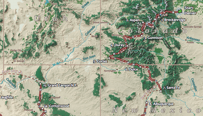
International Champions Tour
Created in my Graphic Design in Cartography class at UW-Madison, this map shows the route, stops and surrounding landscape of a hypothetical bike race in the southwestern U.S.
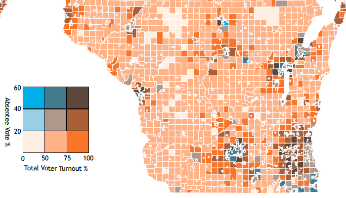
Increasingly Absentee
Also created in my Graphic Design in Cartography class at UW-Madison, this infographic includes information about absentee voting in Wisconsin and uses maps to compare between the 2012 and 2016 elections.
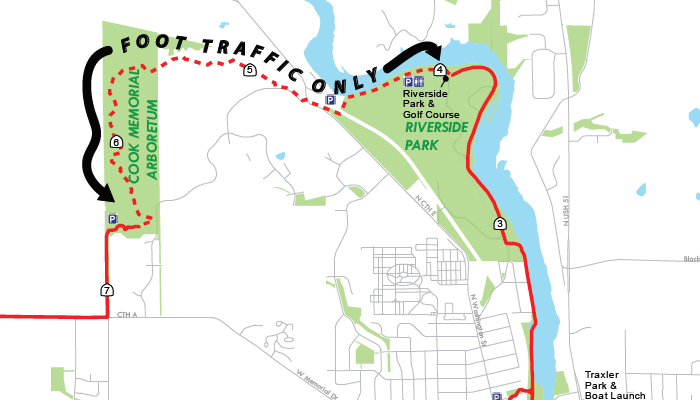
Janesville Trails
Designed as a update to the Janesville Trail Map found in pamphlets throughout the city, this project shows the major trails in the city and adds wayfinding information to help users navigate better.
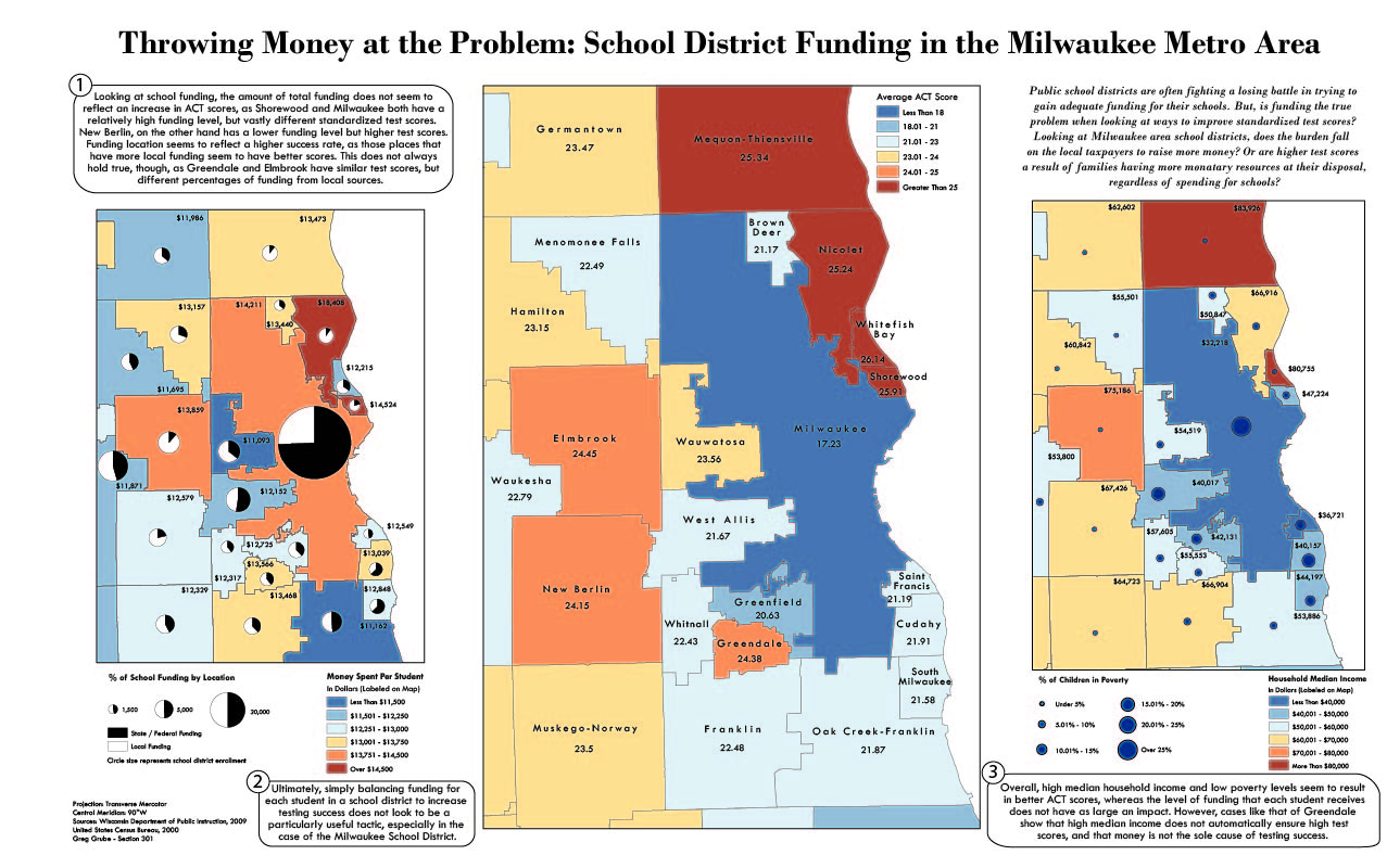
Throwing Money at the Problem
Designed in my Introduction to Cartography class at UW-Madison, this infographic compares funding of school districts in the Milwaukee area to test scores and uses maps to display the various datasets.
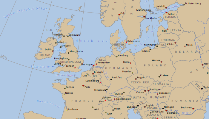
Political Map of Europe
Also designed in my Introduction to Cartography class at UW-Madison, the map shows and labels the countries, major cities and major waterbodies of Europe.